
The Farakka and Gajoldoba barrages are grand proofs of the many negative impacts a barrage has downstream, and Bangladesh itself is a victim of it. Nazrul Islam writes on how barrages are going to turn into a mirage in Bangladesh.
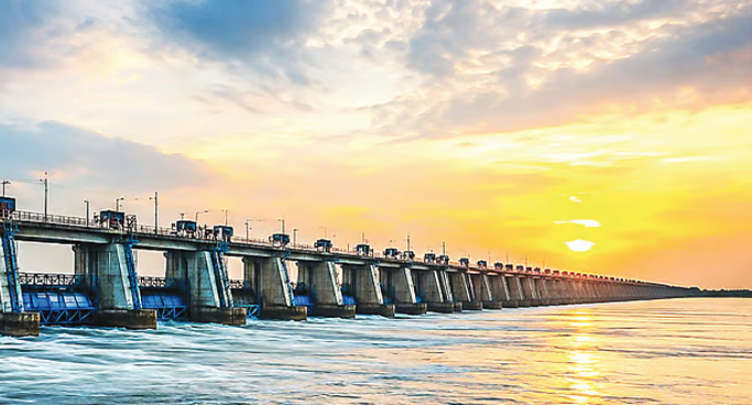
Confusion regarding the barrage
Recently, some confusion has arisen regarding the main objective of barrages in Bangladesh. It is being said from government circles that the proposed barrage will be able to hold the monsoon flow in the river so that it can be used during the winter. Recently, during his visit to Malaysia, Prime Minister Tareq Rahman also expressed this idea. Obviously, he got this idea from the proponents of the proposed Ganges Barrage project and from the ‘feasibility report’ of this project.
But the calculations provided in the feasibility report itself prove that this idea is not correct. For example, this report states that through the barrage at Pangsha, it will be possible to raise the water level to a maximum of 12.5 meters, and as a result, the volume of water stored in the Ganges river in Bangladesh from Pangkha in Rajshahi to Pangsha in Rajbari will be 2.89 billion cubic meters. Meanwhile, we know that the total volume of the monsoon flow of the Ganges in Bangladesh is approximately 28.8 billion cubic meters. That is, the amount of water the proposed Ganges barrage will be able to store (2.89 billion cubic meters) will be only 1.04 percent of the total monsoon flow of the Ganges in Bangladesh!
The matter can be looked at differently as well. For example, the feasibility report of the Ganges Barrage project states that by increasing the water level of the Ganges through the barrage, an average total of 2,768 cumecs of water will be supplied to five distributary rivers of the Ganges in Bangladesh and two pumphouses. This will include 327 cumecs to the Hisna-Mathabhanga on the right bank of the Ganges, 93 to the Bheramara pumphouse, 2,108 to the Gorai-Madhumati, and 300 to the Chandana-Barasia; and 40 cumecs to the Godagari pumphouse on the left bank, 21 to the Boral, and 15.5 to the Ichamati. If this supply were to be made solely from the water stored by the proposed barrage (2.89 billion cubic meters), it would be exhausted in just 7.5 days. Therefore, it is clear that the water that will be supplied to the various branches and pumphouses of the Ganges in Bangladesh by the proposed barrage is primarily from the current flow of the Ganges, not from stored water.
Ganges water will be halved at Pangsha
Noticeably, according to the project’s implementation report calculations, during the dry season (November-May), the volume of water flowing towards the aforementioned seven directions will be 1,210 cumecs. This report also mentions that during the 1997-2010 period, the flow volume of the Ganges in Bangladesh during these dry months was 2,694 cumecs. Thus, the situation stands that of the water that enters Bangladesh past Farakka during the dry season, almost half of it (45%) will not be able to flow towards Goalanda. That is why the project’s feasibility report shows that even though the water level of the Ganges is 12.5 meters upstream of Pangsha, this level drops to below 2 meters downstream.
How the National Economic Council approves the proposed barrage project based on a one-sided feasibility report cannot but evoke surprise.
If monsoon water could be redistributed in winter, then why is there no water in the Padma and Teesta during winter due to the Farakka and Gajoldoba barrages?
In other words, much like how the Ganges water is halved between India and Bangladesh at Farakka during the dry season, the remaining water will be halved between the upstream and downstream areas at Pangsha. There is no escaping this harsh truth. (For more details on these matters, see the interview of prominent Bangladeshi water expert and professor at Commonwealth University in the USA, Md. Khalequzzaman, published in The Daily Star on May 19).
The ‘Mirage’ regarding the barrage
That the monsoon flow of the Padma will mainly be held by the barrage to be used in the winter is a tale (called a ‘myth’ in English) that has little relation to reality. Through this narrative, a mirage is being created regarding the purpose of the barrage, which is never going to be achieved.
This mirage issue will also apply to the proposed second Teesta Barrage. The proposal for this barrage is completely new and sudden. It is also not clear why this barrage needs to be built when Bangladesh already has a Teesta barrage at Dalia, and where its construction is being considered. However, even if it is built, its main function will be to change the geographical direction of the river flow—not to change water availability from the monsoon season to the winter.
In fact, one does not need so many calculations to understand this basic point. The experiences of India’s Farakka and Gajoldoba barrages are right in front of our eyes. If a barrage could primarily redistribute monsoon water into the winter, then why does Bangladesh’s Ganges and Teesta have no water in the winter because of these barrages?
The experience of the Teesta barrage built at Dalia is even more relevant for Bangladesh. If the main job of a barrage is to use monsoon water in the winter, then why is there no water in the Teesta river from Dalia to Chilmari during the winter? Why is the Teesta in crisis today and why is a ‘mega-plan’ needed for the Teesta?
The experience of Kaptai Dam and Lake
Actually, to redistribute water from one season to another, a massive lake is required, which is usually created by a dam rather than a barrage. Bangladesh’s Kaptai Dam is an example of this. The Kaptai Lake created by it has an area of 688 square kilometers and can store 6.48 billion cubic meters of water, which is more than double (224%) the reservoir of the proposed Padma barrage. On the other hand, compared to the Ganges’ 11,500 cumecs in Bangladesh, the average annual flow of the Karnaphuli is 1,901 cumecs, meaning approximately one-sixth of the Ganges.
Therefore, in terms of the volume of the reservoir as a ratio of flow, Kaptai’s capacity is 13.6 times greater than the proposed Ganges barrage. As a result, Kaptai Lake can, to some extent, hold monsoon water and release it during the winter. However, day by day, even that has become difficult. Because, due to siltation, the capacity of Kaptai Lake had decreased by 25% by the 1990s.
It can be estimated that it has decreased by at least another 25% over the last 30 years. As a result, despite this dam, the flow in the Karnaphuli drops below 200 cumecs in winter. Consequently, the amount of electricity generated by the Kaptai Dam drops to just 40 megawatts and sometimes stops completely. In fact, in the future, it will be necessary to remove the Kaptai Dam. Because if it is not done, the Karnaphuli will start flowing over the dam, which will create a dangerous situation. Similarly, despite the addition of under-sluices, siltation will occur upstream of the proposed barrage and the barrage’s water storage capacity will gradually decrease. In addition, a funnel effect will occur upstream, bank erosion will intensify, and the river will become unnecessarily wide.
Impact of the barrage on downstream areas
Since the proposed barrage will halve the flow of the Ganges at Pangsha, it was an important duty of the proponents of this barrage to take into account the impact this barrage will have downstream. But the feasibility report essentially limits its discussion to what positive outcomes there will be upstream of Pangsha due to the proposed barrage, and neglects its negative impact on the downstream. I have discussed previously the harmful effects this barrage will have downstream (‘What solution will the Padma (Ganges) Barrage offer’, Prothom Alo, May 19).
Briefly, five trends of this harmful impact can be identified as follows. Firstly, the dry season flow of the Ganges, Padma, and their distributaries downstream will decrease. Among these are important rivers like the Old Kumar, Ichamati, and especially the Arial Khan, which serves as a water source for most of the rivers in the Barisal division.
Secondly, the seasonal disparity of river flow downstream will become more pronounced. Because, on one hand, the dry season flow will decrease, while the monsoon flow will remain largely unchanged. In some years, it might even increase due to the addition of previously stored water.
Thirdly, this increase in seasonal flow variation will bring about distortion of the river channel. Because more shoals (chars) will form during the dry season than before, and the river will become shallower. Then, to accommodate the monsoon flow, the river will widen by breaking its banks. The Teesta river from Dalia to Chilmari bears witness to this. Fourthly, due to the reduced flow in the dry season, the problem of salinity will increase in the Barisal division and the Meghna estuary. Fifthly, because sediment and sand will get trapped upstream of the proposed barrage, the delta formation process in the Meghna estuary will be hindered.
The Farakka and Gajoldoba barrages themselves are grand proofs of the many negative impacts a barrage has downstream, and Bangladesh itself is a victim of it. Therefore, how the National Economic Council approves the proposed barrage project based on a one-sided feasibility report cannot but evoke surprise.
Alternative methods for using monsoon water in winter
Therefore, without a lake of colossal size, there is ostensibly no way to retain monsoon water and use it extensively in the winter. However, there is one way, and that is to develop the whole of Bangladesh as a dispersed lake. Unfortunately, heavily influenced by foreign consultants and lending agencies for seven decades, Bangladesh has largely walked in the opposite direction. By adopting a cordon approach towards rivers, the country’s floodplains and tidal plains have been continuously isolated from the rivers.
As a result, the countless rivers, streams, canals, beels, jheels, haors, baors, ponds, and dighis of various types and sizes across the country—where river water used to reach during the monsoon and be stored for use in the dry season—have been continuously destroyed. For the same reason, the renewal of groundwater levels and the augmentation of river flow in the dry season through subterranean seepage have largely come to a halt.
One of the two large, nature-provided reservoirs in Bangladesh is the haor area in the northeast, and the other is Chalan Beel in the northern region.
According to researchers, Chalan Beel once had an area of 1,085 square kilometers. To prevent river water from entering various parts of this beel, the Water Development Board has built at least 8 polders inside the beel area and installed many sluice gates and regulators on the rivers and canals. In this way, the WDB has destroyed the character of the beel area. Now, the perimeter of the beel has shrunk to just 168 square kilometers in the monsoon and only 52-78 square kilometers in the dry season. Yet, as a massive water reservoir, Chalan Beel used to maintain the water level balance between the Jamuna and the Ganges during the monsoon, and increased the flow of rivers in the area during the dry season.
The same fate has befallen the haor area in the northeastern part of the country. From about 232.70 square kilometers in 1955, the perimeter of the haor area has shrunk by more than half (55.4%) to 103.60 square kilometers in 2015.
The mirage created around the barrage could boomerang
Therefore, it is not a barrage; what is needed to store Bangladesh’s monsoon water for use in the winter is to revive all the dispersed water bodies across the country. For this, it is necessary to abandon the cordon approach and adopt an open approach towards the rivers. The obstacles that have been built over seven decades in the path of the river’s monsoon flow spreading onto the floodplains and tidal plains must be removed.
The feasibility report of the proposed barrage shows that despite the diversion by Farakka, the water level of the Ganges in Bangladesh during the monsoon reaches 12 to 14 meters below the Hardinge Bridge. It is urgent to investigate and find a solution as to why, despite this, this water cannot flow through the Gorai-Madhumati during the monsoon. Instead of chasing after a barrage, it would be much better for the country if the WDB focused on this task. Conversely, if a mirage is created in the name of a barrage, it will eventually boomerang on the government itself in the long run.
Dr. Nazrul Islam
Professor, Asian Growth Research Institute
Former Chief of Development Research, United Nations
Founder, Bangladesh Environment Network (BEN)
The information presented here is an English adaptation based on the report published on The Daily Prothom Alo.