


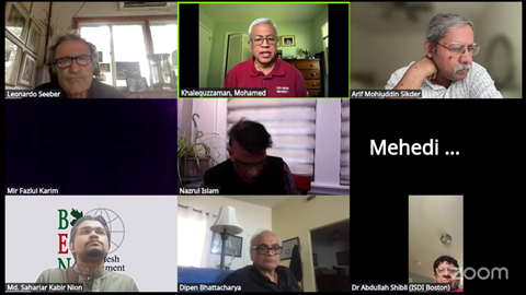
Recent tremors in Narsingdi and Sylhet have rattled more than just buildings; they have shaken the complacency of a nation sitting atop one of the most complex geological intersections on Earth. Yet, within the scientific community, a fierce debate is quietly raging regarding the true nature of our seismic peril. Are we facing an apocalyptic 9.0 magnitude “mega-thrust” earthquake, or is our vulnerability rooted in smaller, localized faults interacting with our reckless urban expansion? This critical distinction was the focal point of the 20th Bi-monthly Webinar organized by the Bangladesh Environment Network (BEN). Chaired by Dr. Md. Khalequzzaman and moderated by Md. Sahariar Kabir Nion, the session featured a clash of geological perspectives, contrasting international models with the ground-truth realities observed by native experts.
For years, a prevailing narrative—heavily influenced by research from Columbia University—has warned of a “locked and loading” mega-thrust fault running directly beneath the Bengal Basin, capable of unleashing a devastating 8.2 to 9.0 magnitude event. However, prominent Bangladeshi geologists are pushing back against this apocalyptic scenario, arguing that such models lack the physical geometric configuration required to manifest in our specific tectonic environment. Mir Fazlul Karim, former Director at the Geological Survey of Bangladesh, strongly contested the mega-thrust hypothesis. “Bangladesh has never historically experienced any earthquake greater than a six [within the basin], except for the Srimangal earthquake,” Karim noted. He highlighted that the subduction zone geometries responsible for 9.0 earthquakes—like those seen on the west coast of South America—simply do not align with the subsurface reality of Dhaka. Designing every structure in the country to withstand a hypothetical 9.0 quake is not only a scientific stretch but a massive, unnecessary economic burden on a developing nation.
Dr. Arif Mohiuddin Sikder of Virginia Commonwealth University further dismantled the mega-thrust panic. He emphasized that the Bengal Basin is a mega-delta weighed down by 15 to 20 kilometers of thick sediment. “The most powerful thing in the universe is gravity,” Dr. Sikder explained. The immense vertical load of these sediments creates crustal warping and hidden faults, which are responsible for the recent moderate tremors we’ve felt. According to Dr. Sikder, while the plate margins to the east are volatile, the mechanics of our “thin-skinned” basin mean the maximum realistic earthquake magnitude here is closer to a 7.0. “If a 9.0 magnitude happened, Dhaka is not going to exist… but how real are these numbers?” he asked, warning that drawing imaginary mega-thrust lines over a delta causes unwarranted panic and misdirects policy planners.
However, rejecting the 9.0 mega-thrust does not mean Bangladesh is safe. Dr. Leonardo “Nano” Seeber, a seismologist from Columbia University, drew urgent attention to a very real and present danger just across our northern border: the Dauki Fault. Extending for roughly 400 kilometers and bordering the Shillong Massif, this active fault has a history of major ruptures, including the devastating 1897 Great Assam earthquake. Dr. Seeber’s research suggests this fault is accumulating significant strain and remains a profound hazard, particularly for northeastern regions like Sylhet. Ultimately, whether a tremor is a 7.0 or an 8.0, the geology only dictates the shaking; it is the engineering that dictates the death toll. Dr. Mehedi Ahmed Ansary, a leading mitigation expert from BUET, brought the geological theories down to the perilous reality of Dhaka’s streets.
Dr. Ansary pointed to the stark contrast between the 2010 earthquakes in Chile (magnitude 8.8, 550 deaths) and Haiti (magnitude 7.0, 140,000 deaths). The difference was not the fault line, but the strict enforcement of building codes. In Bangladesh, despite having robust codes on paper, the implementation protocol is practically non-existent. The threat to Dhaka is critically amplified by our soil. Dr. Ansary presented alarming data showing that new urban developments in areas like Purbachal, Bashundhara, and Jolshiri are being built on soft, recently filled earth. “Due to liquefaction, the moment coming to the building is much higher,” he warned. In these areas, the soil condition is poor up to 45 meters deep. Even a moderate magnitude 6.0 earthquake nearby could cause massive structural failures due to soil amplification, regardless of the building’s internal strength.
The consensus from the BEN webinar is a sobering call to action. We must stop fixating on the apocalyptic, low-probability 9.0 mega-quakes that make international headlines and start preparing for the high-probability 6.5 to 7.5 magnitude events that our local geology guarantees. Our immediate focus must shift from theoretical fault mapping to practical, uncompromising urban governance. As Dr. Ansary proposed, we urgently need mandatory third-party vetting for new constructions and a massive retrofitting campaign for essential buildings. The earth beneath us will inevitably shift; whether our cities stand or fall when it does is entirely up to us.
To watch the full recording of the 20th BEN Webinar on earthquake risks, visit: https://www.youtube.com/live/uA0UsaPFCXI
